Advanced Real-Time Tracking with Comprehensive Mobile Integration
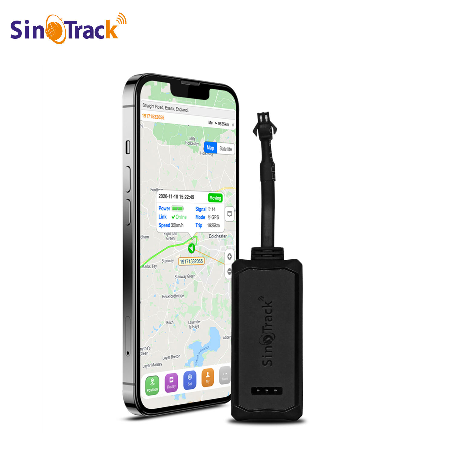
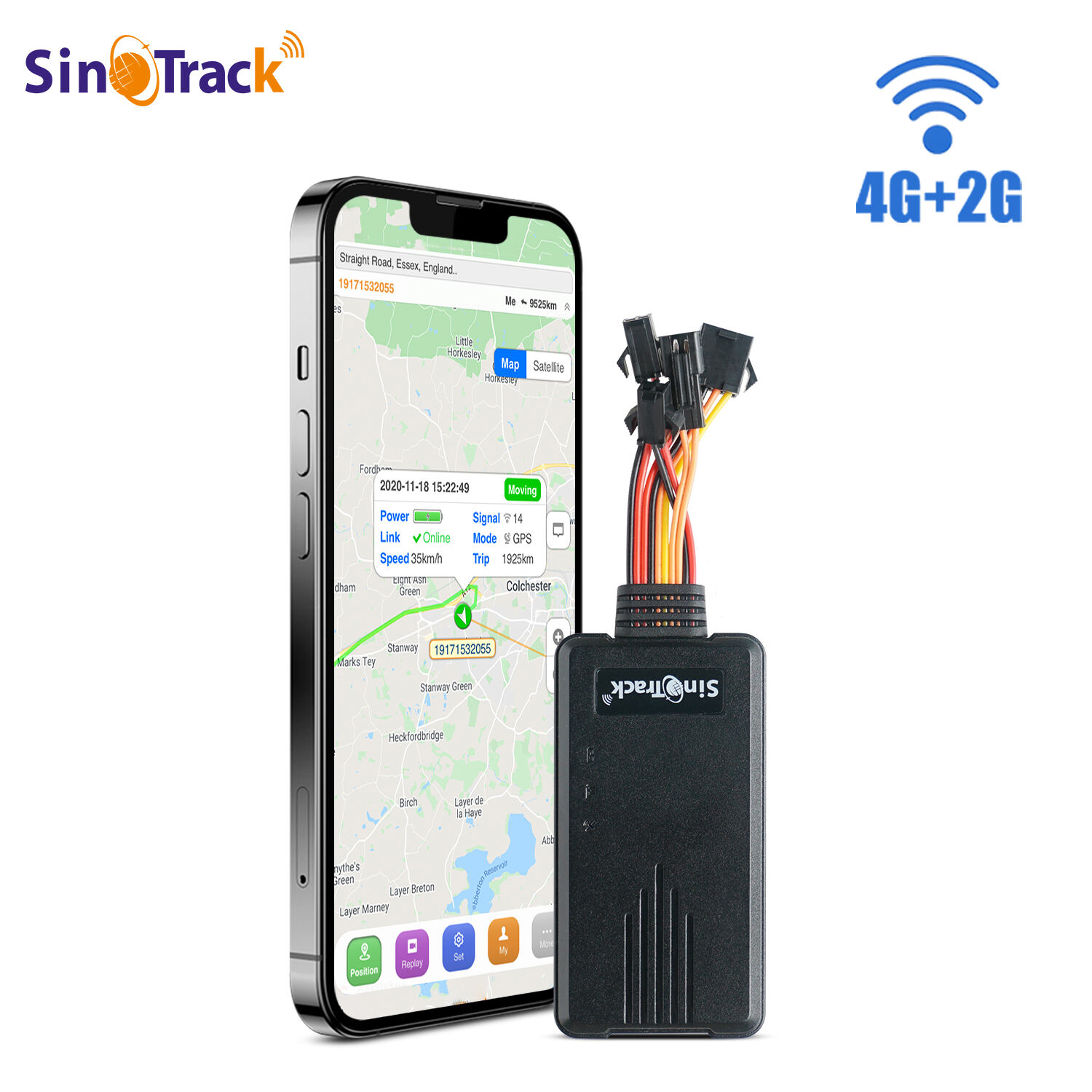
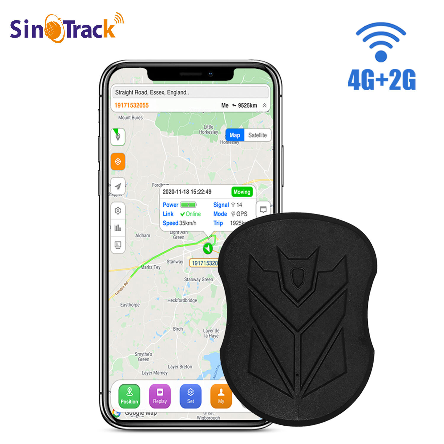
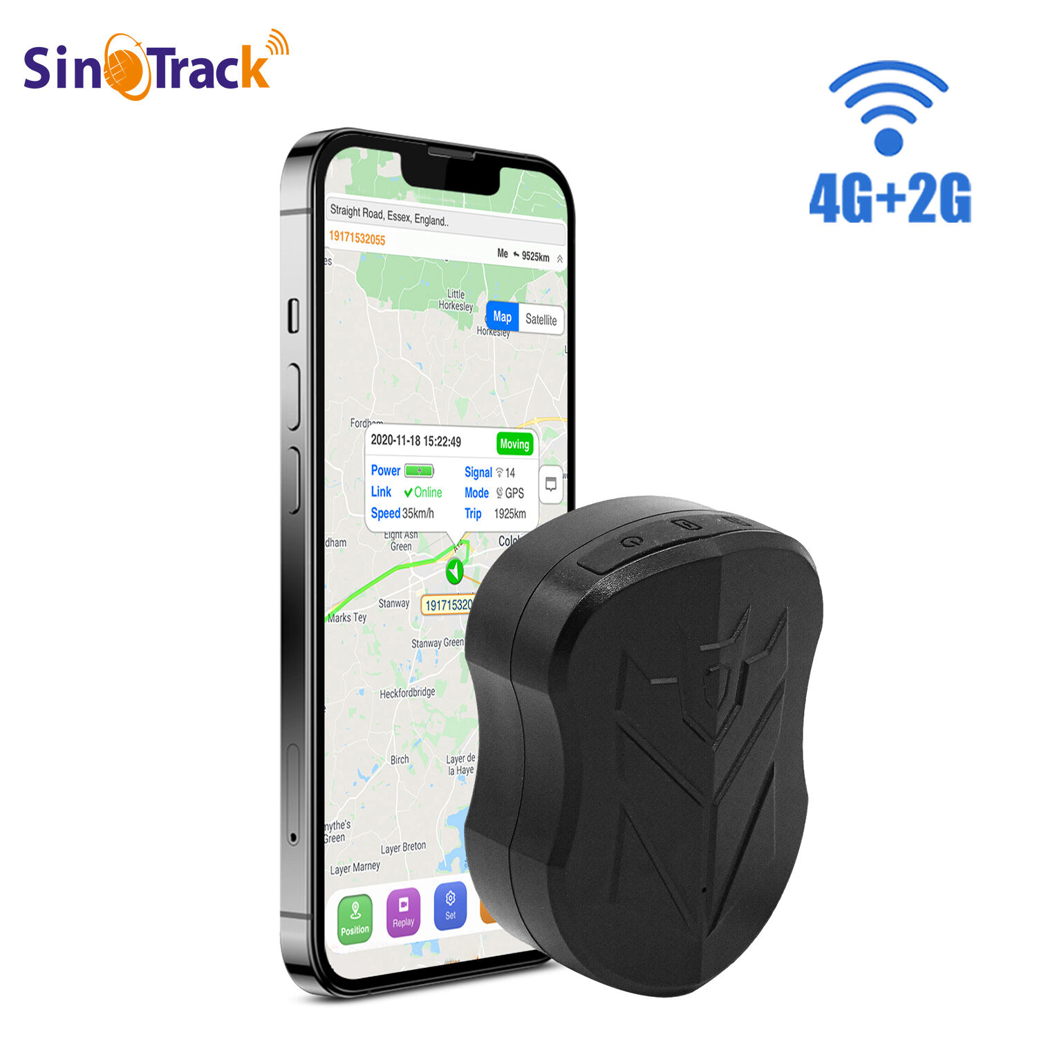
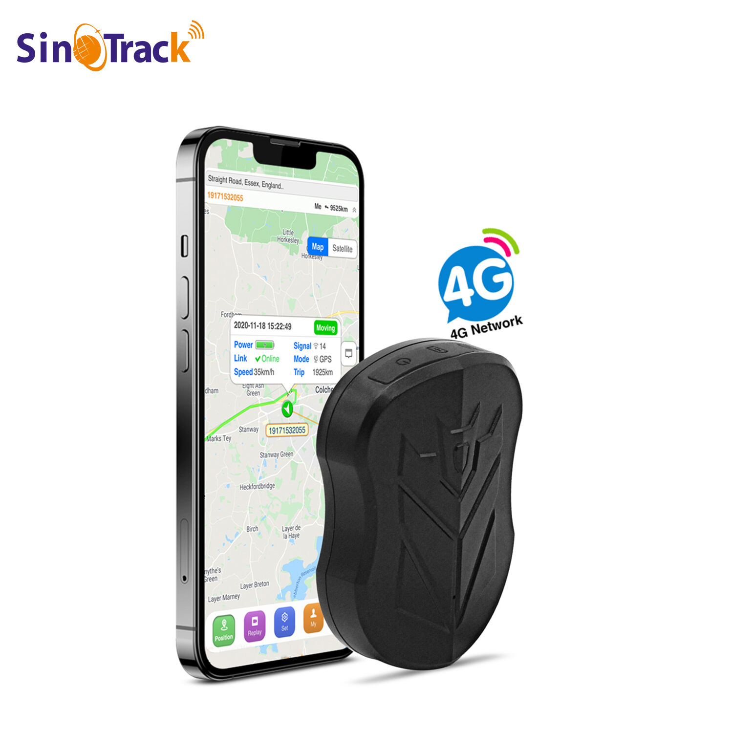
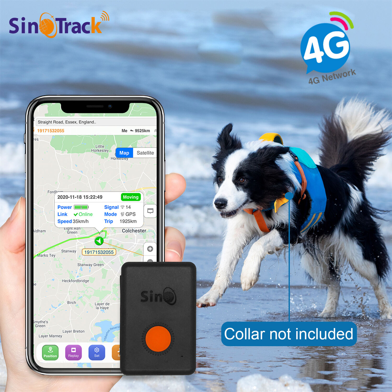
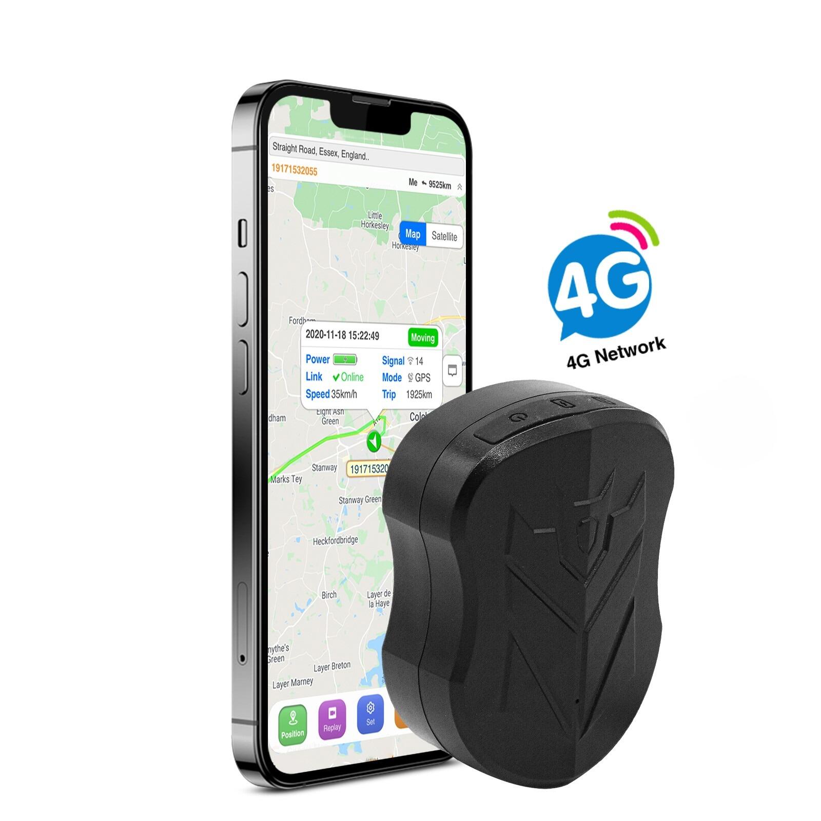
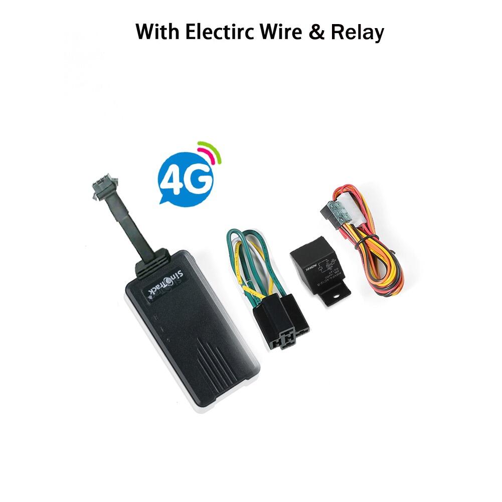
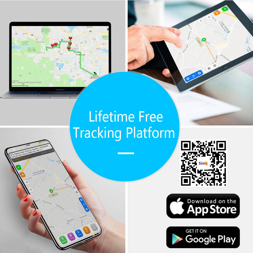
Real-time tracking capabilities represent the technological cornerstone of the hidden magnetic GPS tracker, providing instantaneous location updates through advanced cellular networks and satellite positioning systems. The sophisticated tracking infrastructure delivers precise coordinates within meters of actual position, enabling users to monitor asset locations with exceptional accuracy throughout coverage areas. Advanced GPS receivers incorporate multiple satellite constellation support including GPS, GLONASS, and Galileo systems, ensuring consistent positioning accuracy even in challenging environments with limited satellite visibility. The hidden magnetic GPS tracker utilizes high-speed cellular networks including 4G LTE connectivity that provides rapid data transmission for time-critical tracking applications where immediate location updates are essential. Comprehensive mobile applications offer intuitive interfaces that display real-time positions on detailed maps with satellite imagery, street views, and terrain overlays for enhanced situational awareness. Users can monitor multiple hidden magnetic GPS tracker devices simultaneously through unified dashboards that provide organized views of entire fleets or asset portfolios from single applications. Geofencing capabilities allow users to establish virtual boundaries around specific geographic areas, triggering automatic notifications when tracked assets enter or exit designated zones without authorization. Historical tracking data provides valuable insights through route playback features that display complete movement patterns over specified time periods, enabling analysis of usage patterns and operational efficiency. Speed monitoring alerts notify users when tracked vehicles exceed predetermined velocity limits, supporting fleet management and teen driver supervision applications. The tracking platform includes sharing capabilities that allow authorized users to access location information through secure links or dedicated applications, facilitating coordination among family members, business partners, or emergency responders. Advanced filtering options enable users to customize map displays, notification settings, and reporting parameters based on specific monitoring requirements and preferences. International tracking support ensures continued operation across borders and cellular networks, maintaining consistent monitoring capabilities during travel or cross-border transportation activities.