Introduction to Car GPS Trackers and Real-Time Tracking
Car GPS trackers are pivotal devices that provide vehicle owners with real-time location data, significantly enhancing safety and aiding in recovery efforts in case of theft. Utilizing GPS trackers allows for accurate monitoring of vehicle positions, thus offering peace of mind to owners by minimizing the risk associated with vehicle theft and unauthorized use. The capability to track a car's location in real-time is not only vital for personal vehicles but also for commercial fleets, where timely data aids in efficient management and logistics operations.
The rise of smart technology and IoT has made GPS tracking more accessible and affordable for both personal and commercial use. This technological evolution has expanded the application of GPS tracking beyond traditional use, integrating it with IoT devices for broader functionality. As a result, car GPS trackers are now able to provide enhanced features like geofencing and real-time traffic updates, further augmenting their value in maintaining security and operational efficiencies.
How GPS Tracking Technology Works for Vehicles
Understanding how GPS tracking technology functions in vehicles is essential for appreciating its real-time tracking capabilities. At its core, GPS tracking relies on a constellation of satellites orbiting the Earth. These satellites continuously send signals to GPS receivers embedded in vehicles. The receivers calculate precise locations using a method called trilateration. This involves measuring distances from at least three satellites, which allows for accurate location data to be received on the user’s device.
Satellite Connectivity and Trilateration
Satellite connectivity is the backbone of GPS tracking technology. The satellites emit signals received by the GPS device in the vehicle. When a GPS tracker is active, it uses trilateration, which is the process of triangulating its position using signals from at least three satellites. This method ensures that the receiver can pinpoint the vehicle's exact location. Trilateration not only enhances precision but also ensures that the GPS system remains operational, even in challenging environments such as urban areas with tall buildings or remote rural locations.
Data Transmission Methods
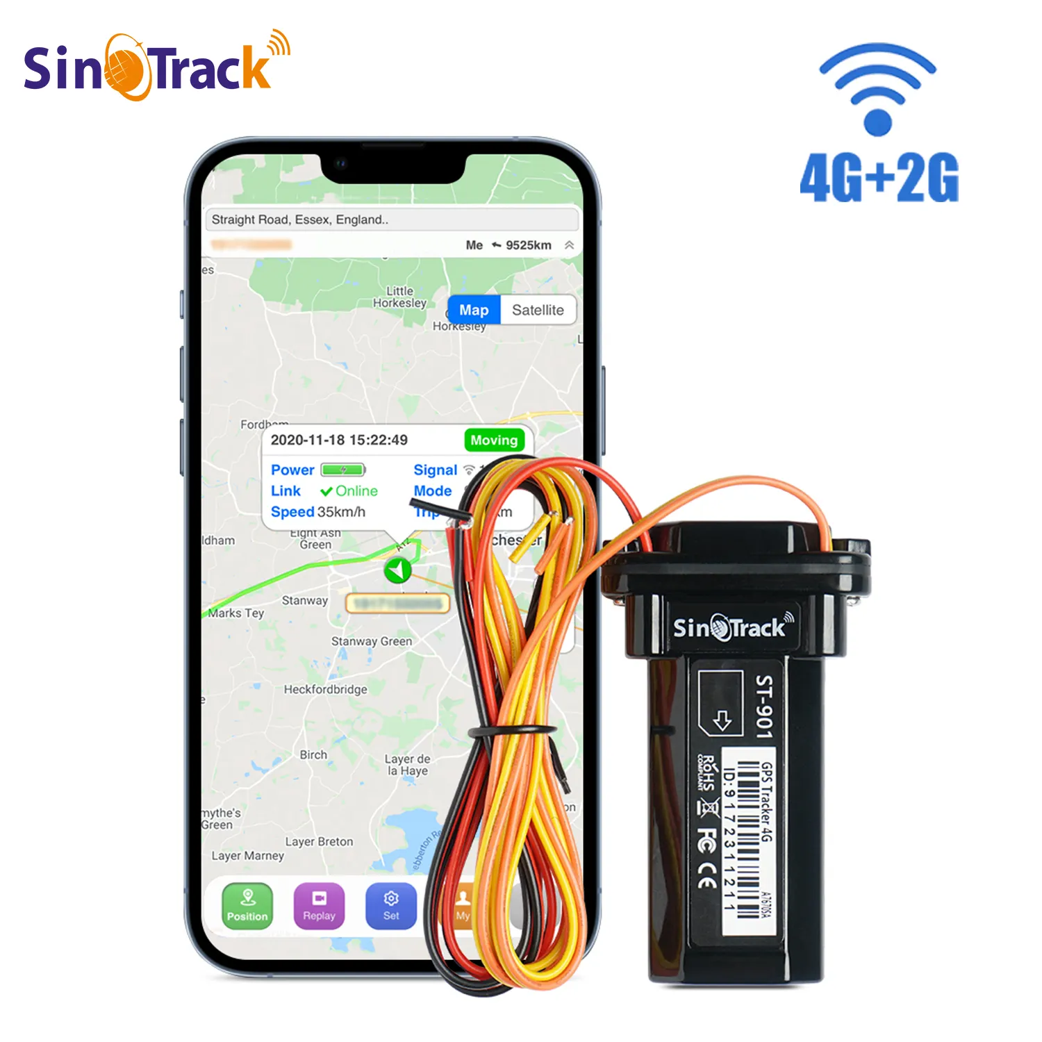
GPS trackers utilize various data transmission methods to relay location data, including GSM, CDMA, and satellite communications. These methods determine how quickly and reliably information can be sent to and from the GPS device. For instance, GSM systems utilize cellular networks, making them ideal for urban settings. In contrast, satellite communications can cover more remote areas but might be slower due to the distances involved. Selecting the appropriate transmission method depends on factors like coverage needs and environmental conditions, with each option offering different advantages in terms of speed and reliability.
Role of Cellular Networks
Cellular networks play a pivotal role in GPS tracking by facilitating the transmission of GPS data from the vehicle to the end user. Through these networks, users receive immediate updates and alerts about their vehicle’s location. This is particularly beneficial in urban settings, where the density of cellular infrastructure allows for fast and consistent data relay. Cellular networks ensure seamless communication between the GPS device and user, providing real-time monitoring and enhancing the overall reliability of the tracking system.
Factors Influencing Car GPS Tracker Accuracy
Signal Obstruction Challenges
Signal obstruction is a primary factor impacting the accuracy of car GPS trackers. Buildings, bridges, and dense foliage can block or reflect GPS signals, creating inaccuracies in tracking data. For instance, structures like skyscrapers may cause a "multipath effect," where signals bounce off surfaces, leading to discrepancies in location data. Understanding these obstruction challenges is essential for planning optimal use cases for GPS trackers, ensuring effective navigation even in urban jungles or wooded areas.
Environmental Interference Factors
Environmental conditions significantly influence GPS tracking effectiveness. Heavy rain, snowfall, or urban depth can all interfere with signal reception. For example, extreme weather conditions such as thunderstorms can temporarily disrupt GPS signals, causing delays in tracking updates. Therefore, evaluating the effectiveness of GPS systems in diverse environmental conditions helps users choose trackers with robust performance capabilities for reliable data even when nature challenges signal pathways.
Device Hardware Quality
The quality of the GPS tracking device is crucial for maintaining high accuracy. Devices built with advanced technology often Support more sophisticated algorithms, boosting overall precision. High-quality trackers are equipped to handle complex data with greater sensitivity and processing speed, reducing susceptibility to inaccuracies. Utilizing superior hardware ensures users benefit from accurate GPS data, even when environmental or infrastructural interferences are present. High-end GPS systems generally demonstrate better reliability compared to entry-level devices, aligning with industry needs for precision in diverse conditions.
Real-Time Tracking vs. Delayed Updates: Accuracy Implications
Latency in Location Reporting
Latency in location reporting is a critical factor that can impact the efficacy of real-time GPS tracking. When location data is delayed, users may not receive timely information, which can compromise decision-making, especially in scenarios requiring immediate response, such as navigation in fleet management or emergency services. To address these challenges, it is crucial to consider technical specifications that focus on minimizing latency. By optimizing the communication path between GPS trackers and user interfaces, vehicles can be monitored effectively, ensuring timely interventions when needed. This enhances not only the user experience but also improves operational efficiency across various applications.
Impact of Refresh Rates
The refresh rate of GPS data plays a significant role in determining tracking accuracy and effectiveness. A higher refresh rate means that location updates occur more frequently, providing up-to-the-minute data that is essential for real-time tracking applications like fleet management. This not only enhances situational awareness but also contributes significantly to safety and operational planning. For instance, logistics companies rely on high refresh rates to ensure that they can adjust routes in real-time, avoid delays, and maintain efficient operations. Investing in GPS systems with higher refresh rates can lead to more precise data, ultimately facilitating better-informed decisions and optimizing resource allocation.
Advancements Improving GPS Tracker Precision
Multi-Constellation Satellite Systems
The incorporation of multi-constellation satellite systems in GPS trackers is a significant advancement that enhances positioning accuracy. By accessing multiple satellite constellations, such as GLONASS, Galileo, and BeiDou, GPS devices can provide more precise location data even in challenging environments. This approach is crucial for overcoming issues posed by satellite outages and signal loss, offering robustness and reliability in tracking solutions. These advanced systems ensure continuous and accurate tracking, which is particularly beneficial in fleet management and logistics where precision is paramount for operational efficiency.
AI-Powered Signal Processing
Artificial intelligence plays a transformative role in refining GPS signal processing, helping improve accuracy and optimize performance. By integrating AI into GPS systems, trackers can predict and rectify errors caused by environmental factors like buildings or varied terrains. Additionally, AI can address hardware limitations, ensuring the data remains precise. This technological enhancement not only boosts GPS tracking reliability but also provides valuable insights into optimizing routes, thereby reducing fuel consumption and improving safety measures. The role of AI in fine-tuning GPS systems is increasingly important as industries strive for smarter and more efficient tracking solutions, aligning with the growing demand for precision in tracking devices.
Frequently Asked Questions
What are the main benefits of using car GPS trackers?
Car GPS trackers offer benefits like real-time location tracking, enhanced security, theft recovery, efficient fleet management, and operational logistics improvements.
How does GPS trilateration work?
GPS trilateration calculates a vehicle’s precise location by measuring distances from at least three satellites, allowing for accurate location data to be transmitted to the user’s device.
What types of data transmission methods do GPS trackers use?
GPS trackers use data transmission methods like GSM, CDMA, and satellite communications, deciding the speed and reliability of information relayed to and from the GPS device.
How do environmental factors affect GPS tracker accuracy?
Environmental factors like heavy rain, buildings, and dense foliage can obstruct GPS signals, creating inaccuracies in tracking data. It's crucial to plan optimal use considering these conditions.
What advancements have improved GPS tracker precision?
Advancements such as multi-constellation satellite systems and AI-powered signal processing have significantly enhanced GPS tracker precision, offering robust tracking solutions in challenging environments.